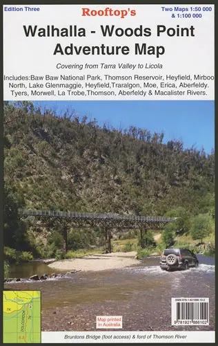
Description
Unveil the beauty of Victoria’s wilderness with Rooftop’s Walhalla – Woods Point Adventure Map. This double-sided gem covers an extensive area from Tarra Valley to Licola and includes noteworthy locations like Baw Baw National Park, Thomson Reservoir, Heyfield, Mirboo North, Lake Glenmaggie, Traralgon, Moe, Erica, Aberfeldy, and the Tyers, Morwell, La Trobe, Thomson, Aberfeldy, and Macalister Rivers. It’s a detailed guide for all outdoor enthusiasts.
Flip the map, and you’re transported from Walhalla, a historic town brimming with stories, to the breathtaking landscapes around Woods Point.
Rooftop Maps are renowned for their precision, ensuring you have accurate information for navigation and exploration. Whether you’re seeking hidden trails, diving into local history, or scouting prime fishing spots, this map empowers you to immerse yourself in the natural beauty and rich heritage of the region.
Key Features
- Detailed 4WD tracks
- National parks
- Camping areas
- GPS surveyed roads & tracks
- Waterproof paper
Key Specifications
Edition: 2nd
Publication Date: 01/01/06
Scale: 1:100,000
Folded size (WxHxD): 145mm x 255mm x 4mm
Flat size (WxH): 700mm x 1000mm
Explore more from our collection.
Reviews
There are no reviews yet.