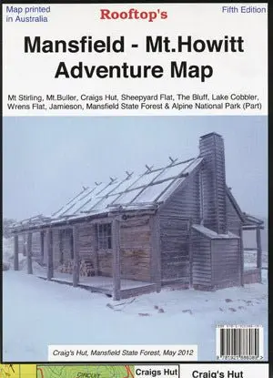
Description
Map coverage is from Mansfield and Lake Cobbler in the north to Jamieson, Kevington and Mount Sunday in the south. It includes Craig’s Hut, Sheepyard Flat, Mount Buller, Mount Stirling, Howqua Hills, Jamieson River, Mansfield State Forest, Alpine National Park (part), King Billy, and Macalister Springs. Scale is 1:100,000.
The reverse of the map has a 1:50,000 scale enlargement titled ‘Sheepyard Flat – Craig’s Hut Forest Activities Map’ with contours.
Shows all parks, reserves, state forests, fish and camping spots with GPS co-ordinates.
This map is perfect for exploring Mt Stirling, Stirling Circuit Road, and Craig’s Hut.
Explore more from our collection.
Reviews
There are no reviews yet.