Description
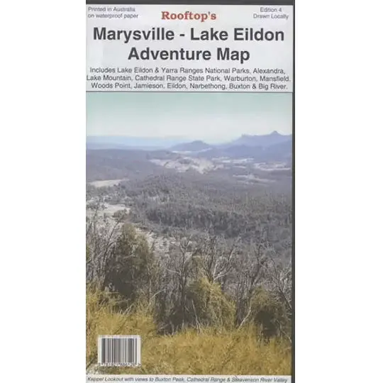
Discover the captivating landscapes of Victoria’s High Country with the Rooftop Maps ‘Marysville – Lake Eildon Adventure Map’. This double-sided map is your gateway to a world of outdoor exploration, covering Lake Eildon, the Yarra Ranges National Parks, and an array of remarkable destinations including Murrindindi, Mansfield, Alexandra, Marysville, Woods Point, Lake Mountain, and Cathedral Ranges and Jamieson.
Rooftop Maps are known for their precision and reliability, making them the trusted choice for outdoor enthusiasts. With this map in hand, you’ll have the most accurate information at your fingertips, empowering you to navigate with confidence and explore the stunning landscapes of this diverse region.
Key Features
- Detailed 4WD tracks
- National parks
- Camping areas
- GPS surveyed roads & tracks
- Waterproof paper
Key Specifications
Edition: 4th
Publication Date: 01/01/09
Scale: 1:100,000
Folded size (WxHxD): 135mm x 245mm x 4mm
Flat size (WxH): 700mm x 1000mm
Explore more from our collection.
Reviews
There are no reviews yet.